-
Region
-
Experiences
-
Vitality
-
Events
-
Service

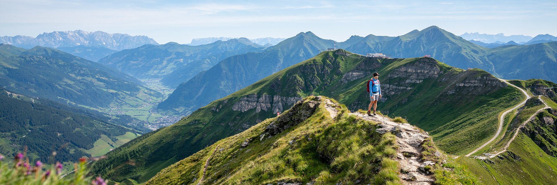
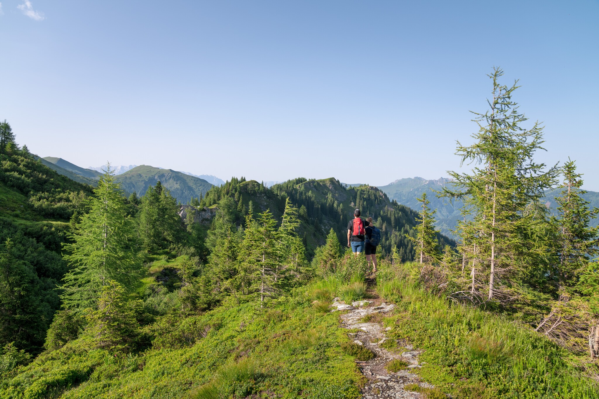
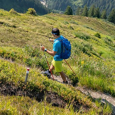
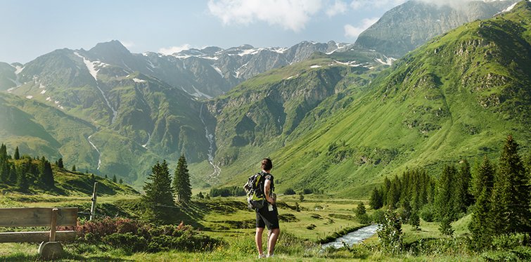
Long-distance hiking through impressive mountain scenery
Gastein Trail - Every step takes you further
In 7 stages across gentle meadows, to farmed alpine pastures and up imposing peaks.
Through three places that are as diverse as the landscape that surrounds them: Here, hikers experience the kind of relaxation that can only be found in the great outdoors. On the Gastein Trail, this experience can be felt like nowhere else.
In 7 daily stages, the Gastein Trail leads from Dorfgastein high above Bad Gastein back to Bad Hofgastein: 87 kilometers and 4,587 meters in altitude have to be covered. Hikers who complete this route are greeted by a backdrop that once attracted emperors and princes and enjoy a unique mountain world with spectacular peaks, rustic huts and idyllic mountain lakes along the way.
To ensure that your hike runs smoothly, you canplan and book your trip conveniently via the Trail Angels Info & Booking Center . The experienced specialists offer you individually tailored packages with accommodation, luggage transport and other services.
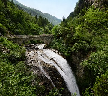
Highlights on the Gastein Trail
-
Experience the Gastein Valley in all its facets
-
Culinary highlights: Regional alpine specialties on traditional alpine pastures
-
Varied routes: Across secluded alpine pastures, challenging stages and enjoyable promenades
-
Famous, time-honored valley towns: with great history and alpine flair
-
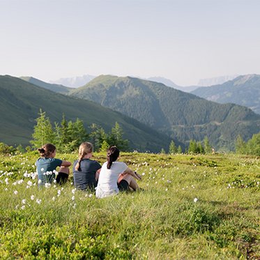
Breathtaking views: of the three-thousand-metre peaks of the Hohe Tauern National Park
-
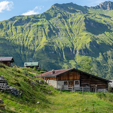
Varied accommodation: Overnight stays on rustic alpine pastures, in traditional huts and comfortable hotels


Von Etappe zu Etappe
So verläuft Ihre Weitwanderung durch Gastein
In der interaktiven Online-Wanderkarte finden Sie alle Abschnitte des Trails samt GPX-Daten zum Download. Die GPX-Daten lassen sich bequem auf GPS-Geräten oder Wander-Apps verwenden und helfen Ihnen bei der sicheren Orientierung unterwegs – auch ohne Mobilfunkempfang.
Difficulty
X
Difficulty
Route Length
X
Route Length
9 Hikings found
list view | map view


Signage
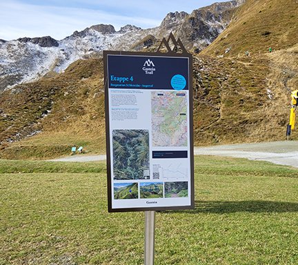
Stage starting point - everything at a glance
Each stage begins with its own starting point. There you will find compact information about the route, the most important highlights, altitude and estimated walking time. Ideal for orientation and motivation before the start.

Blue sticker - your guide through the Gastein Valley
All signposts along the Gastein Trail carry the blue sticker. This means you can see at a glance that you are on the right path - reliably and clearly marked all the way to the stage finish.
Plan, discover, start hiking
Well prepared for the Gastein Trail
A multi-day long-distance hike through the Gastein Valley requires not only anticipation, but also good planning. From the right equipment to the right travel time and how to get there by public transport - here you will find all the important information for a safe, enjoyable and nature-conscious hiking experience on the Gastein Trail.

Arrival
Equipment
Best time to travel
FAQs
Animal & nature conservation
Requirements for the hiker

For your long-distance hike on the Gastein Trail
Professional service from Trail Angels
The Trail Angels ensure that your hiking trip on the Gastein Trail is not only impressive, but also relaxed. You can conveniently book your individual hiking package via the Trail Info & Booking Center - with selected accommodation, luggage transport and many other services along the long-distance hiking trail through the Gastein Valley.
- All-round support with the mobility service
The comprehensive Trail Angels mobility service includes daily luggage transport (with the exception of stages 1 and 2), shuttle transfers to your accommodation, return transport to the starting point and additional transfers if required - only bookable in combination with overnight stays at partner businesses.
- Well looked after along the way - your extra safety
The Trail Angels' Trail Info & Booking Center offers digital travel documents, a daily trail hotline, optionally bookable mountain hiking guides and additional services such as a train station shuttle.

Your hike to look up
Discover the Gastein Trail
The Gastein Trail brochure offers you a compact overview of all stages, altitude, accommodation and highlights along the route.
Simply immerse yourself.
In healing thermal water.

A valley you should experience
Welcome to your active vacation
Gastein is more than just the starting point of the Gastein Trail - it is a valley full of energy, variety and alpine joie de vivre. The three stage towns of Dorfgastein, Bad Hofgastein and Bad Gastein accompany your long-distance hike with scenic and cultural diversity.
Travel comfortably and environmentally friendly by train and simply leave your car behind. Start your hiking adventure directly from the train station.


Digital reminder with summit book
Gastein Trail hiking pins
Record your Gastein Trail hike digitally and reward yourself with a special souvenir: with the free SummitLynx app, you can document your stages and collect hiking badges in bronze, silver and gold.
ith each digital check-in at the defined stage destinations, you document your route. Step by step, you create a personal summit book of your long-distance hike through the Gastein Valley. As a reward, you will receive a digital certificate - an unforgettable memento of your hike on the Gastein Trail.
What you should know - FAQs
Can I take dogs with me on hikes in Gastein?
In principle, dogs may be taken on hikes. Dogs must be kept on a lead on hikes. If other animals (cows, horses, ...) come towards you, take the dog off the lead - it is faster than the other animals and can run away. In public transportation (buses, but also gondolas), dogs must be kept on a lead and muzzled.
If you want to take a dog with you, please contact the hut in advance.
What does the overnight stay on the mountain pasture look like?
The Trail Angels will organize your accommodation along the Gastein Trail - including the rustic mountain huts. All reservations are coordinated in advance to ensure your sleeping place in a shared room or dormitory. Please note: A sleeping bag is mandatory in some huts . Earplugs are also recommended for a good night's sleep. As not all mountain huts offer card payment, you should carry sufficient cash with you.
What do I do in an emergency?
Even on a well-organized hike, it is important to be prepared for unforeseen situations. Please remember the following emergency numbers:
-
Euro emergency number: 112
-
Mountain rescue: 140
The Euro emergency number also works without a SIM card and in any available network. If you are in a dead zone, the following tip will help: switch your cell phone to flight mode or restart it. Instead of the PIN code, dial 112 directly.
For even more safety on the move, we recommend downloading the emergency call app. It is the easiest way in Austria to alert the rescue service or special forces such as mountain or water rescue. It connects you to the emergency rescue service and transmits your exact location at the same time.
Requirements for hikers
The Gastein Trail is a long-distance hiking trail for experienced mountain hikers who want to move safely on marked hiking trails in alpine mountain regions at altitudes of up to 2,300 meters. For the Gastein Trail you need alpine hiking experience, which in addition to the correct self-assessment also includes experience in orientation in the terrain, including reading topographical maps and how to behave in bad weather.
We would like to point out that despite our tour organization on the Gastein Trail, you are on your own responsibility .
Hiking with a dog is possible on the Gastein Trail. However, if you take your four-legged companion with you on alpine pastures, there are a few basic rules to follow.
Technical demands: Moderate
-
Moderately difficult mountain trails with red markings according to the Alpine Association
-
Narrow, often steep passages
-
Short insured sections may occur
-
Weather-related challenges such as fog or slippery paths
Required: sure-footedness, alpine experience and a certain head for heights
Fitness requirements: higher to high
-
Ascents of up to 1,300 meters depending on the stage
-
Descents of up to 1,000 vertical meters depending on the stage
-
Route length between 3 and 7.5 hours walking time
-
The physical exertion varies depending on the stage.
Particularly demanding: Stage 5 "Angertal - Sportgastein" with a walking time of up to 7.5 hours.
Other stages such as stages 2, 3, 4 and 6 are shorter. - The Gastein Trail is suitable for children aged 12 and over in very good physical condition.
- The long-distance hiking trails and trekking routes are less or not suitable for people with limited mobility due to their demands.
- Rest days can be planned individually.
Tip: It is strongly recommended that you prepare yourself by hiking similar physical demands beforehand as a day tour.
If you have any questions, please contact the Trail Info & Booking Center before booking.
Equipment for the Gastein Trail
You will need alpine hiking equipment for the Gastein Trail:
- High-quality hiking boots with good tread soles
-
Weatherproof, warm clothing for high alpine sections (altitudes between 1,300 m and 2,300 m)
-
Trekking poles strongly recommended (especially for descents)
-
Sufficient provisions and water
-
A hut sleeping bag is mandatory for certain stage destinations such as Heinreichalm and Hofgasteinerhaus
-
We also recommend a towel and slippers (Biberalm)
When is the best time to travel the Gastein Trail?
The best time for a hike on the Gastein Trail is from mid-June to mid-September. During this time, the mountain pastures are open, the paths are usually free of snow and the conditions are ideal for a long hike lasting several days.
-
June: The mountain pastures open after the winter, nature is fresh and blooming.
-
July & August: Perfect conditions for hikes at altitudes between 1,300 and 2,300 meters. Pleasant temperatures despite the summer heat in the valley.
-
September: Crystal-clear air, the onset of autumn colors and ideal hiking conditions - an insider tip for anyone looking for alpine tranquility.
Conditionally suitable: From mid-September to the end of October, when some mountain pastures are already closed. Early snowfall can also affect the route. The Trail Angels offer a special package with suitable stages for this period.
Unsuitable: The Gastein Trail is not accessible from November to mid-June. Snow and closed huts make hiking impossible during this time.
What is important for a careful approach to nature?
Nature in the Gastein Valley is a precious natural heritage - sensitive and powerful at the same time. Therefore, please stay on the marked paths, respect grazing areas and take your garbage back into the valley.
Protected plants are part of this valuable natural area and should grow where they belong. With your respectful behavior, you contribute to the long-term preservation of the mountain world.
Find out more about respectful treatment of grazing livestock.
This might also interest you:

Hiking in Gastein

Thermal baths in Gastein

Gastein A - Z

